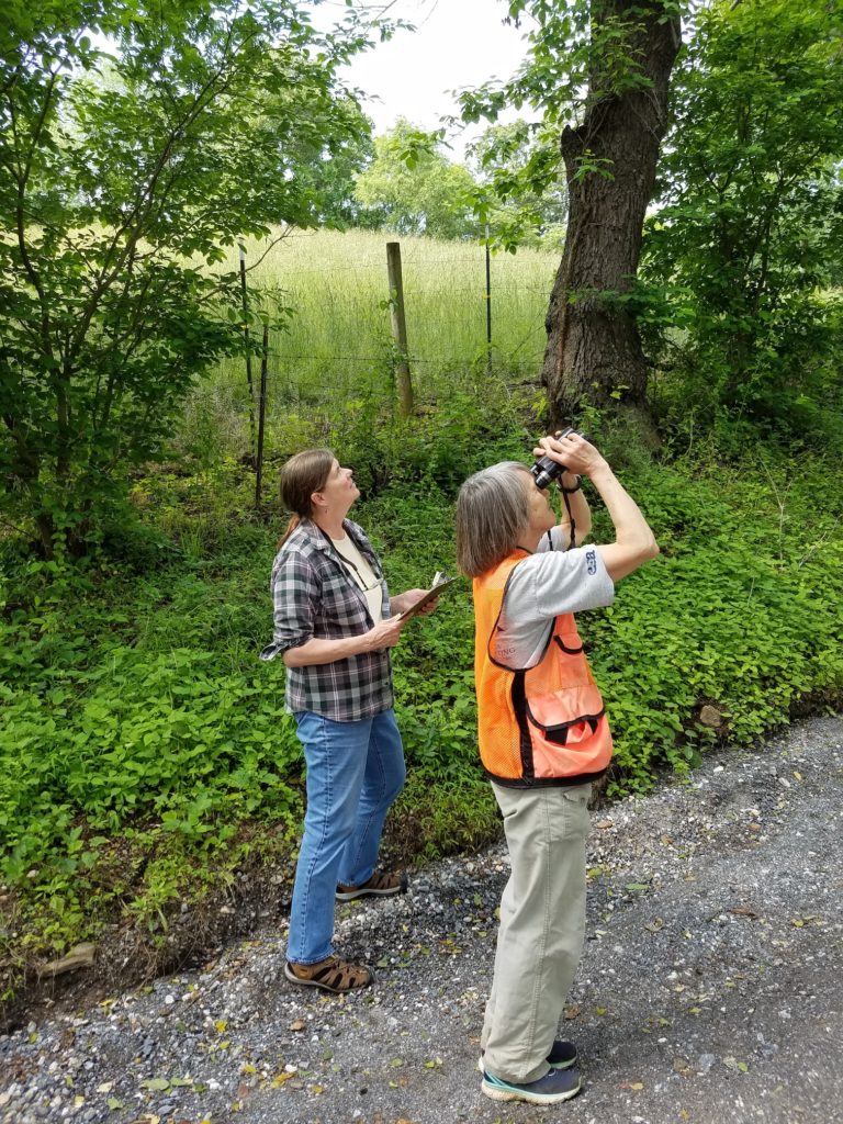
It was inching toward 4 a.m. on Sunday, June 13, and this reporter and Elaine Nakash were scrambling to get on the road. The two News Review staffers were heading to Carroll County, Maryland, to conduct a Breeding Bird Survey route and needed to be at the route’s starting point, ready to go, by 30 minutes before sunrise. They knew the routine, having done another route in Carroll County the previous Sunday morning.
The routes are part of the North American Breeding Bird Survey (BBS), which tracks the status and trends of North American bird populations. The BBS was developed and launched in 1966 by the late Chandler Robbins, a noted ornithologist and Dawson’s longtime colleague at the Patuxent Wildlife Research Center, where the program is headquartered. There are over 4,000 routes scattered across the continental U.S. and Canada, about 2,500 of which are run each year. (BBS routes also have been established in northern Mexico, but few of these have been run regularly.) Each route consists of 50 stops spaced at half-mile intervals along a 24.5-mile driving route along secondary roads (mostly). At each stop, an observer identifies and counts all birds seen or heard within a timed three-minute period.
Conducting a Route
Each route is run once each year during the height of the bird breeding season: June for most of the U.S. and Canada. Dawson aims to run her two BBS routes on Sundays, when traffic is lighter. Both routes start north of Westminster, one heading southward, the other heading to the east (route starting points and directions of travel were randomly selected when the BBS was designed). Although geographic coordinates are available for stop locations, Nakash, the driver, finds it much faster to use the car’s odometer and visual descriptions – directly opposite a very small shed, just beyond mailbox 4710, at end of guard rail, etc. – to ensure that the stops are made in the same spots each year. Having run these routes since 1985 (yikes!), Dawson recognizes most stops almost immediately but there always are some changes from year to year – most often new houses.
At each stop, Dawson, the observer, starts a timer and calls out the birds as she hears or sees them, with Nakash tallying and recording the counts on pre-printed data sheets. Dawson detects most birds by ear, identifying them by their songs or calls, but must keep alert for silent birds – for example, the belted kingfisher or green heron that fly over, or the eastern bluebirds quietly perched on a fence. Three minutes can go by quickly if there is a lot of bird activity – or slowly if there are lots of cars, which Nakash counts and records. Once the timer alarm sounds, Dawson and Nakash jump back into the car and drive on to the next stop. After 30 or so stops, their energy begins to wane, but they must keep up the pace to finish the route within the recommended five hours. Over the course of the route, about 60 bird species will have been detected and counted. While Dawson and Nakash both enjoy being out in the early morning to observe birds, BBS routes are physically and mentally taxing to conduct, and the exhausted Greenbelters are glad to arrive safely home.
What Happens Next
Dawson still needs to enter the count data from her routes into the online BBS database, and the program data analyst will produce new population trend estimates later this year. The BBS is the primary source of long-term, large-scale population data for more than 400 of North America’s breeding bird species (see mbr-pwrc.usgs.gov), and BBS results are used by federal and state wildlife agencies and non-governmental organizations to identify bird species of concern and to formulate habitat conservation priorities.
For more information and an interesting overview article on the origins, roll-out and conduct of the BBS, go to pwrc.usgs.gov/bbs.


